Understanding Lanark Highlands Through Maps
Storytelling Through Maps
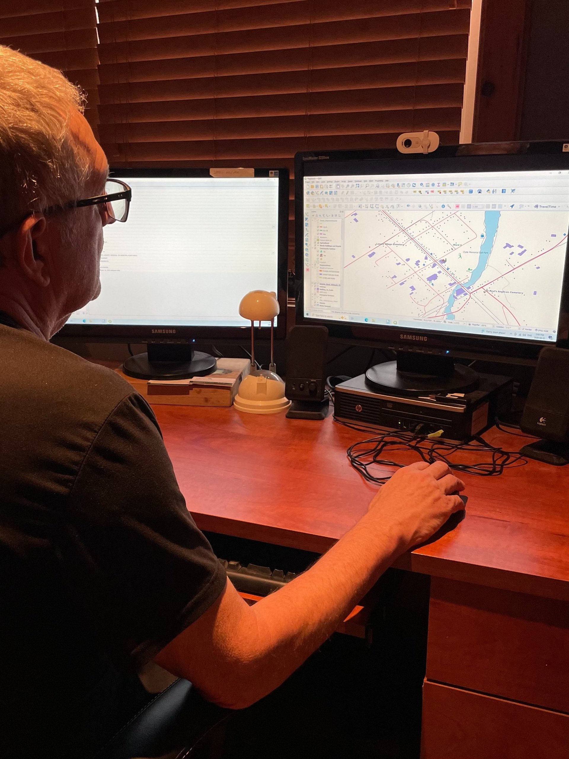
Maps have been telling stories about our surroundings for thousands of years. GIS is a tool for map makers, that was invented in the 1960’s by Dr. Roger Tomlinson in Ottawa, and is used globally now.
If you're not sure what GIS is, just pick up a Smart Device and open a map. Ask "where is the nearest Gas Station?" Or ask it to find directions to where you want to go or where the nearest restaurant is, and what do the reviews look like. These are all examples of using a GIS.
GIS is a powerful tool in finding and displaying information that is easy to understand. Over the past few years, I have taken up collecting open source data, and creating spatial data from text data, to build a GIS about Lanark Highlands and Lanark County....and then ask any type of question.
GIS is a tool, when fully utilized, can make a Municipality run more efficiently, and cost effectively, leading to operational savings and better use of tax dollars!
Here are some maps you may find interesting:
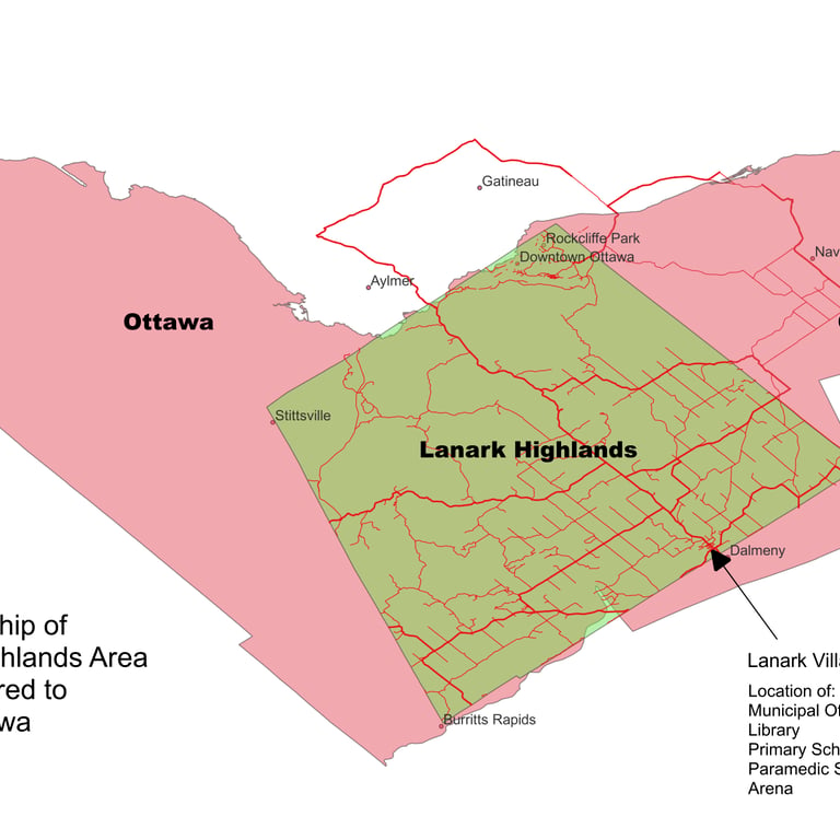
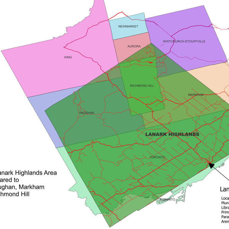
Lanark Highlands is BIG!...over 1,000 square km. Lanark Highlands is larger than Toronto and most of York Region. Lanark Highlands covers a good portion of Ottawa Carleton. Now compare our population of 5,700 to Toronto’s approximately 4.5 million and Ottawa’s 1 million!
How Big is Lanark Highlands?
Click on image to enlarge.
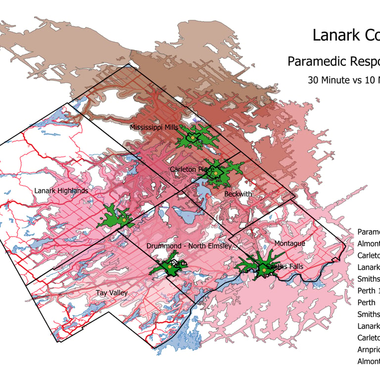
What do our Paramedic Response times look like?
Paramedic Services are the responsibility of Lanark County. There are maximum response time goals that they must achieve. These numbers apply to the County average, but not to Lanark Highlands individually. The Green areas show approximately how far you can drive in 10 minutes (the Paramedic goal), and the pink areas show approximately 30 minutes. Lanark Highlands has the largest area that is in excess of 30 minutes.
Have you ever had to wait an hour for a Paramedic? My neighbours have!
Click on image to enlarge.
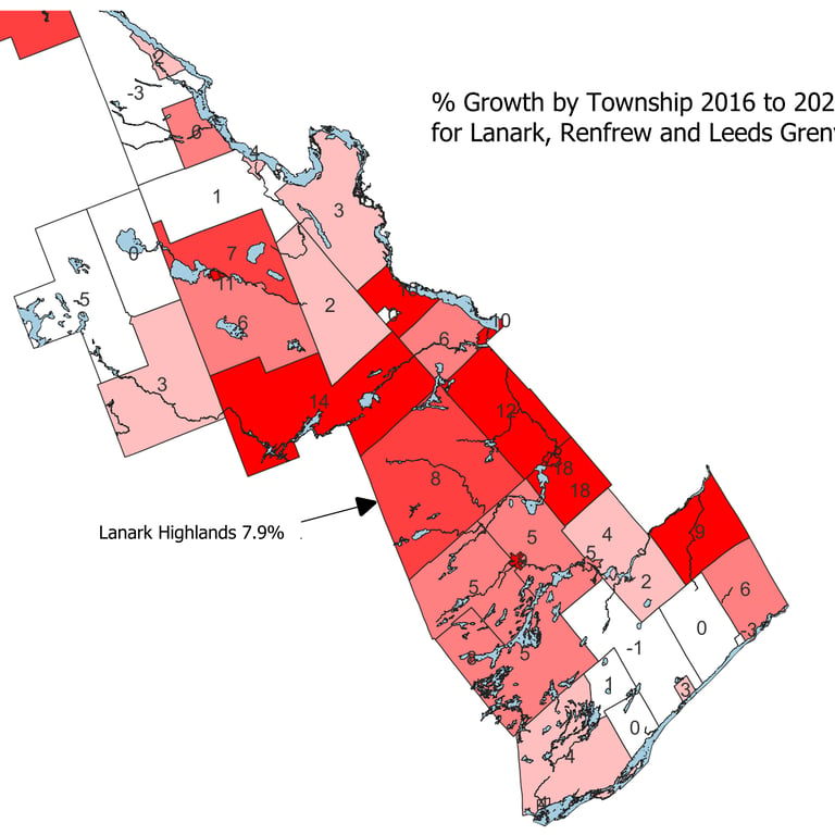
How fast is Lanark Highlands Growing compared to surrounding Townships?
From Statistics Canada, Lanark Highlands grew by 7.9% between 2016 and 2021. The next Census happens this year. I will update this information when it's released. This map shows the growth by Township for Renfrew, Leeds Grenville and Lanark Counties. The darker the red, the greater the growth. Considering some Townships have shrinking populations, our rate of growth is fairly healthy.
The question is, are we adequately providing services now and planning efficiently for the future?
Click on image to enlarge.
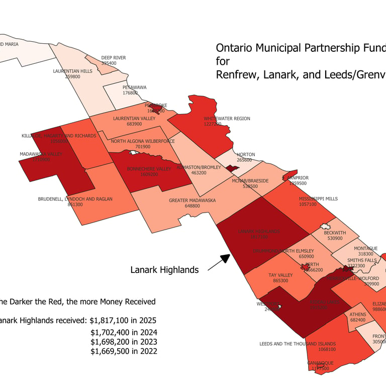
How well is Lanark Highlands supported by the Province compared to surrounding Township?
The Ontario Municipal Partnership Fund (OMPF) is the Province's main general assistance grant to municipalities, providing a total of $600 million in unconditional funding to 388 municipalities through the 2026 OMPF program.
In 2026, Lanark Highlands will receive $1,987,100. Are we making the best use of this money?
Click on image to enlarge.
Connect
Questions? Comments? Reach out anytime.
© 2026. All rights reserved.
Designed by Stationhouse Studio
Local photography by Liana Sodonis
Phone
613-879-3622